Working with spatial GIS data
Table of contents
Overview
CloudBeaver supports the visualization and management of spatial data. Spatial data, which includes geographic locations and geometric shapes.
Spatial data, often represented as either geometric or geographical values, can be visualized on a map or graph. A geometric object is typically composed of a sequence of points that define its shape. For a more comprehensive understanding of spatial data, you can refer to this detailed explanation.
CloudBeaver's support of spatial data covers the following databases:
- PostgreSQL (PostGIS)
- Greenplum

- CockroachDB
- MySQL
- MariaDB
- SQLite (GeoPackage)
- H2GIS
- SAP HANA
- DuckDB
- Redshift
- Exasol
- Altibase
- BigQuery
- Oracle
- SQL Server
- Snowflake
AlloyDB
Spatial data viewer
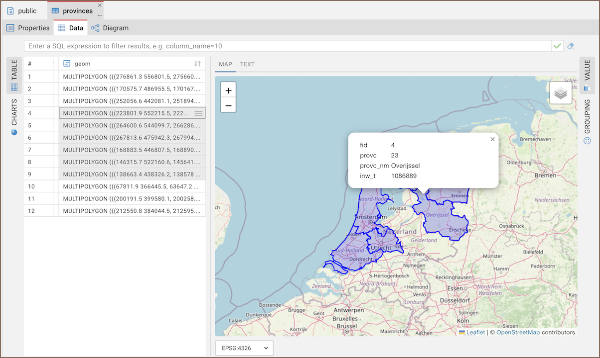
To access the spatial data viewer, select one or more rows containing GIS data from your table. After selecting the rows, open the Value Panel to display the selected spatial data on a map. For more information, see Value Panel.
Abilities of the Spatial data viewer
- Zooming: Allows you to zoom in and out to tailor the map view, using either the mouse wheel or the on-screen icons.
- Map display options: You can choose between street or topography map view.
- Data interaction: When you click on a spatial object on the map, CloudBeaver displays associated information from every other column in the corresponding row.
- Coordinate Reference System (CRS) selection: A dropdown menu in the viewer allows you to select the appropriate CRS for your data. For more information about CRS, see Spatial reference system.