Working with Spatial GIS data
Spatial data is a geometry or geography value that can be represented on a map or a graph. The geometry object consists of a series of points. More details.
DBeaver's support of spatial data covers the following databases:
- PostgreSQL (PostGIS.md)
- MySQL
- SQLite (GeoPackage.md)
- H2GIS
- SAP HANA
- Oracle

- SQL Server
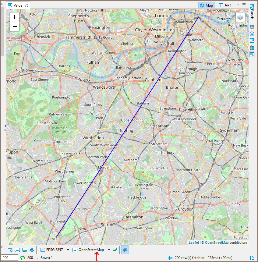
Spatial data viewer

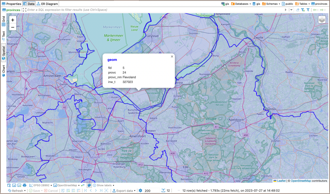
Tile layer management
DBeaver ships with several predefined map tiles. The tiles can be chosen with the combo below the viewer:
You can choose which tile layers you want to see in the combo in the manage dialogue. In the same manage dialogue, you can add new tile layers, edit layers you previously added, or delete them.
Defining custom tile layer
At this point, you may be wondering what to put in the Layers definition box. Here is a brief explanation.
DBeaver's spatial data viewer uses Leaflet (version 1.4.0 at the moment) under the hood. When providing Layers definition, you type the arguments for function L.tileLayer(), which installs a new tile layer. More on that function in the official Leaflet documentation. You can also see the definition of predefined tiles to help you get started.
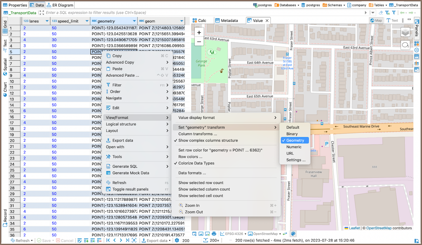
Viewing string or binary data from any Database on a map
You can also see your geodata on the map if you select the data cell setting "View/Format", then "Set columnName format" and among the formats - Geometry. This works for both string and binary types of columns.
 String column type to spatial.
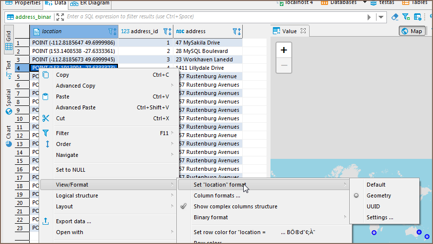 Binary column type to spatial.